Blue Ridge + Smokies
← All Expert Templates
Expertmulti park

Blue Ridge + Smokies

Photo by Yifu Wu on Unsplash

Route Overview

Map
Day 1
Day 2
Day 3
Day 5
Day 6

Park Photos

Shenandoah National Park photo

An East Coast classic that links Shenandoah, the Blue Ridge Parkway, and Great Smoky Mountains.

Itinerary

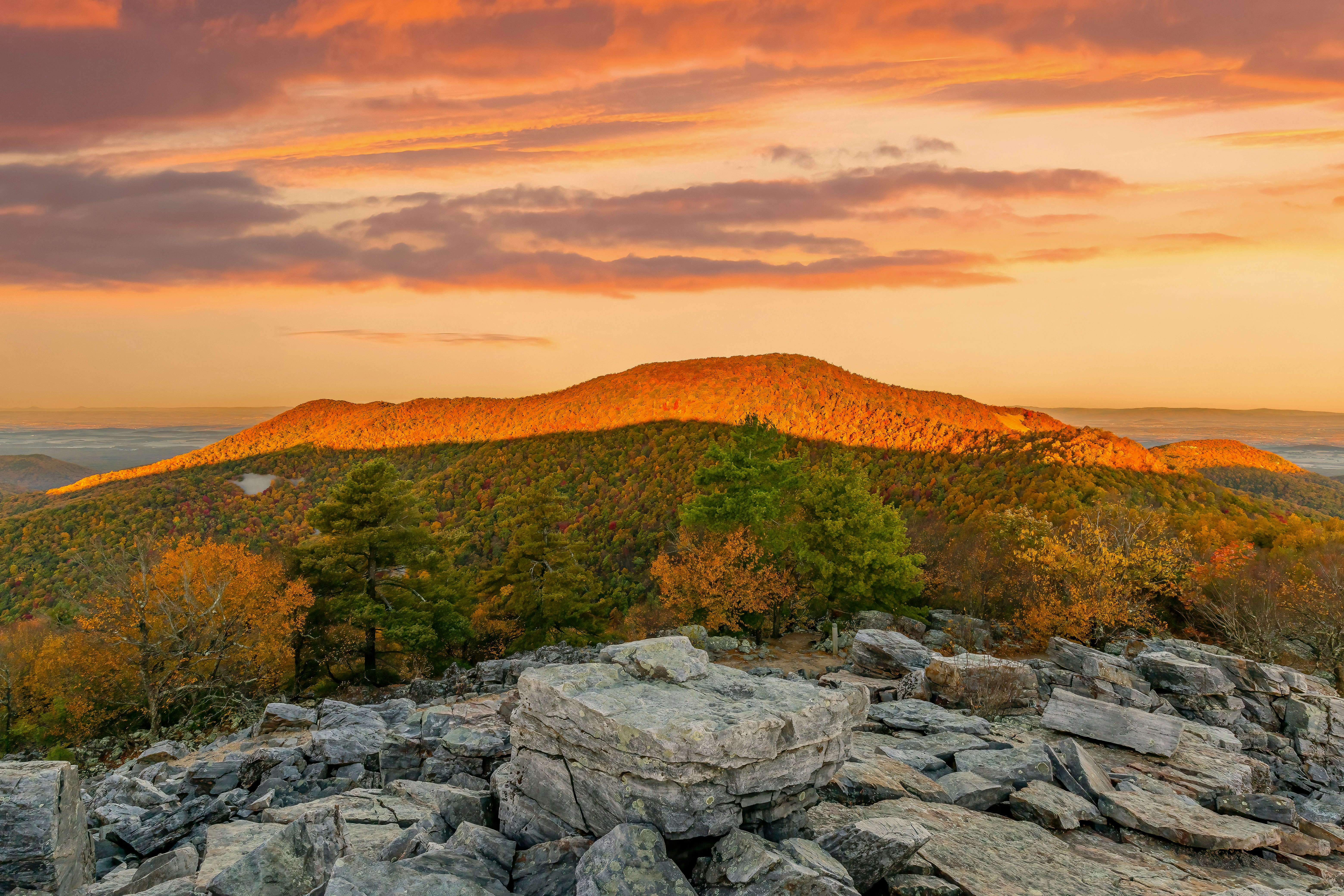
Skyline Drive and short summit hikes.

08:00
👀

Skyline Drive - Panorama Overlook

Shenandoah National Park
30 min

Mile 41.7, just at the northern entrance to Skyland is the highest point on Skyline Drive at 3,680 feet. The highest point in Shenandoah is the summit of Hawksbill Mountain at 4,050 feet. Getting to the summit entails a relatively short hike of less than 2 miles.

My Notes

Morning views across the Shenandoah Valley.

Tips

Great early light for photos.

#place#highest point along skyline drive#shenandoah national park
View on NPS Website
09:30
🥾

Stony Man Trail

Shenandoah National Park
120 min

MILE 41.7 | Pets are not allowed on this hike. This enjoyable hike brings you to an outstanding view of the Shenandoah Valley, Massanutten Mountain, and beyond.

My Notes

Short summit hike with wide views.

Tips

One of the best short hikes in the park.

#hiking
View on NPS Website
13:00
👀

Big Meadows area

Shenandoah National Park
60 min

Skyline Drive (mile 51) | Perched on top of a mountain, this high-elevation meadow can come as a bit of a surprise after the miles of lush, green forests that make up most of Shenandoah National Park. A must-see for every visitor, stop by Big Meadows to explore the trails, grab a bite to eat, or talk to a Ranger at Byrd Visitor Center.

My Notes

Open meadows and frequent deer sightings.

Tips

Good spot for a picnic break.

#place#big meadows#shenandoah national park#meadow
View on NPS Website

More overlooks and waterfalls.

08:00
🥾

Hawksbill Summit Trail

Shenandoah National Park
180 min

Hawksbill Gap Parking Area (mile 45.5) | A shorter, yet steeper route to Shenandoah’s highest peak. The viewing platform on top of Hawksbill offers a magnificent 360-degree panoramic view of the Shenandoah Valley, the Blue Ridge Mountains, and the Virginia Piedmont.

My Notes

Highest peak in the park with panoramic views.

Tips

Start early for cooler temps.

#hiking
View on NPS Website
13:00
🥾

Dark Hollow Falls Trail

Shenandoah National Park
120 min

Dark Hollow Falls Parking Area (mile 50.7) | Pets are not allowed on this hike. This hike follows a stream to a beautiful waterfall, and is one of the Park’s most traveled trails. The trail is short, but very steep and rocky and the return hike is challenging!

My Notes

Short waterfall hike with a steep return.

Tips

Take it slow on the climb back up.

#hiking
View on NPS Website
16:30
👀

Skyline Drive - Loft Mountain Overlook

Shenandoah National Park
30 min

Mile 41.7, just at the northern entrance to Skyland is the highest point on Skyline Drive at 3,680 feet. The highest point in Shenandoah is the summit of Hawksbill Mountain at 4,050 feet. Getting to the summit entails a relatively short hike of less than 2 miles.

My Notes

Southern park overlook with sunset light.

Tips

Great final stop before leaving.

#place#highest point along skyline drive#shenandoah national park
View on NPS Website

Drive a highlight section with overlooks and short trails.

10:00
👀

Blue Ridge Parkway - Peaks of Otter

Blue Ridge Parkway
90 min

The Peaks of Otter has been a favorite stop for travelers for 8,000 years on their journeys across the mountains. Most have stopped along the banks of Stony Creek to refresh themselves with spring water, replenish their strength with a good meal, and rest in the cool shade of the forest. The Peaks of Otter picnic area offers creekside tables, charcoal grills, restrooms, and allows you the chance to become part of this millennia old traveler’s tradition.

My Notes

Classic ridge views and short walks.

#place#picnic tables#picnicking#creek#grill#trails#flat top trail#abbott lake trail#polly woods ordinary#abbott lake#restrooms
View on NPS Website
15:00
👀

Linn Cove Viaduct

Blue Ridge Parkway
60 min

One of the most complicated concrete bridges ever designed and constructed, the Linn Cove Viaduct is a beautiful and inspiring stop along the Blue Ridge Parkway.

My Notes

Iconic viaduct with a short trail.

#place#bridges#viaducts#blue ridge parkway#environmental preservation#mountains
View on NPS Website

Continue the Parkway toward the Smokies.

Cades Cove and key viewpoints.

08:00
🏛️

Sugarlands Visitor Center

Great Smoky Mountains National Park
45 min

Wander through a cove hardwood forest with streamside views, rock walls, and historic stone chimneys on this half-mile (0.8 km) loop along a paved, flat trail. The trailhead is adjacent to a small parking area with several accessible spaces along Newfound Gap Rd (US 441) near Sugarlands Visitor Center.

My Notes

Get oriented with current trail conditions, maps, and road updates.

Tips

Pick up the current parking tag and ask about waterfall flow levels.

#hiking
View on NPS Website
09:15
🥾

Laurel Falls Trail

Great Smoky Mountains National Park
120 min

Hike 2.6 miles (4.2 km) roundtrip through a mixed hardwood forest to an 80-foot (24-m) waterfall. Enjoy a few views of the mountain landscape before arriving at the waterfall. PLEASE NOTE: Laurel Falls Trail is expected to close starting in mid-December for 18 months.

My Notes

Classic Smokies waterfall hike on a paved trail.

Tips

Arrive early for parking; the trail gets busy by mid-morning.

Photo Spots: Waterfall views from the mid-trail overlook.
#hiking
View on NPS Website
12:00
👀

Newfound Gap Overlook

Great Smoky Mountains National Park
30 min

A scenic high-elevation overlook with panoramic mountain views and a large parking area.

My Notes

Iconic ridge view on the TN/NC line with wide mountain layers.

Tips

Bring a light layer; wind can be strong at the gap.

Photo Spots: Layered blue ridges across the park.
#place#newfound gap#overlook#highway 441#high elevation
View on NPS Website
17:30
👀

Clingmans Dome sunset

Great Smoky Mountains National Park
90 min

Clingmans Domer Tower provides a breathtaking view of the surrounding Smoky Mountains National Park. The Tower also has a story to tell - it was architecturally significant within the history of the National Park Service and a model for other towers that were built across the NPS.

My Notes

Short walk to the observation tower for sunset views.

Tips

Bring a headlamp for the return; temps can drop fast.

Photo Spots: Sunset light on the highest peak in the park.
#place#tower#lookout#clingmans dome#mountains#mission 66#architecture#modern architecture
View on NPS Website

Waterfalls and high-elevation overlooks.

06:30
🚗

Cades Cove Loop (sunrise)

Great Smoky Mountains National Park
150 min

Human history in Cades Cove started long before the 1800s. Humans have been using the land in this area for thousands of years. The earliest artifact collected in the park is a lithic dated to 7000 BCE. Though they may not have built structures in Cades Cove that are present today, the impact of the Cherokee is felt throughout the cove. Many trails created by the Cherokee are still traveled by visitors hiking or driving today. One of these trails is now Rich Mountain Road which connected the cove to the Tuckaleechee area. Many settlers followed in the Cherokees’ footsteps and used this route and others to reach Cades Cove. The Cherokee, like settlers after them, cut logs for structures and fires. They cleared land for agriculture, and they hunted, foraged, and traded or bought what they didn’t grow themselves. In the early 1810-1820s, Sequoyah developed the Cherokee syllabary, a written version of the Cherokee language. The Cherokee name for Cades Cove is Tsiyahi, “Otter Place.” Otters were found throughout the many creeks and streams in the cove, but they were extirpated from this area in the 1920s, after being hunted and trapped for their valuable pelts. The park reintroduced them in the 1980s and they have made a remarkable comeback. Today they are often seen near Abrams Falls. The name “Abrams” stems from Cherokee Chief Abram or Abraham, known as Ooskuah to the Cherokee. The origin of the name “Cade” also likely came from Cherokee Chief Cade (or Kade) from this area. A “cove” is a flat valley between mountains or ridges. Most of the Cherokee living in the Southeastern United States were forcibly removed starting with the Indian Removal Act in 1830 which offered territory in Oklahoma in exchange for land in this region. In 1835 the Treaty of New Echota ceded most of the Cherokee lands east of the Mississippi to the federal government. These actions resulted in the “Trail of Tears” in 1938, where 16,000 Cherokee were forced to walk 1,200 miles west. Thousands died in the process. The Eastern Band of the Cherokee who live on the Qualla Boundary adjacent to the park today are the descendants of the few who remained, escaped, or those who returned. A visit to Cherokee, North Carolina offers visitors an opportunity to learn more about Cherokee history and culture. Typically, when a national park or protected area is created, many spaces that people lived in and used are returned to nature. In Cades Cove, this idea is blended with historic preservation. Cades Cove has far fewer buildings than it did at peak settlement around 1900 with over 700 residents. Instead of agricultural fields, today there are grasses and native plants. The cove is actively managed using mowing and prescribed fire to keep trees and woody shrubs at bay. If the cove wasn’t managed this way, it would revert to forest in most areas and look very similar to the woods found throughout the park.

My Notes

Wildlife-rich valley loop with historic cabins and open fields.

Tips

Enter at sunrise for the best wildlife viewing and light.

Photo Spots: Misty fields and deer or black bear sightings.
#place#great smoky mountains national park#cades cove#cades cove overlook
View on NPS Website
09:45
🥾

Abrams Falls Trail

Great Smoky Mountains National Park
180 min

Walk 5 miles (8 km) roundtrip through rhododendron, hemlock, and pine-oak forest to a 25-foot (7.6-m) waterfall and scenic pool. Swimming in the pool is not recommended due to slippery rocks and a dangerous undertow.

My Notes

Moderate hike to one of the park's most impressive falls.

Tips

Trail is rocky; watch your footing near the river.

Photo Spots: Wide waterfall with emerald pool.
#hiking
View on NPS Website
13:30
🍽️

Cades Cove Picnic Area

Great Smoky Mountains National Park
60 min

A leafy 81-site daytime recreational area with tables, charcoal grills, restrooms, and a nearby camp store.

My Notes

Shaded picnic break before finishing the loop.

Tips

Bring your own lunch; services are limited inside the cove.

#place#picnic#picnic area#picnic table#day use#restroom
View on NPS Website
15:00
👀

Cades Cove historic cabins

Great Smoky Mountains National Park
60 min

A concession stable offering horseback-riding trips and rides through forests and meadows of Cades Cove.

My Notes

Short walks to historic churches and cabins.

Tips

Stop at pullouts to avoid blocking loop traffic.

#place#horseback riding#cades cove#point of interest
View on NPS Website

Return rental car and fly home.

Creates a copy you can customize

7

Days

16

Stops

moderate

Difficulty

Best Season

April-November with October for peak fall color

Tags

#multi-park#road-trip#shenandoah#blue-ridge-parkway#great-smoky-mountains